
3D Laser Scanning: Accurate Existing-Condition Documentation
When working with an existing building, structure, industrial facility, or construction site, accurate field measurements are essential. Even a small measurement error can create problems during design, fabrication, coordination, and construction. Traditional measurement methods can also be time-consuming, particularly when projects involve complex structures, difficult-to-access areas, or large facilities.
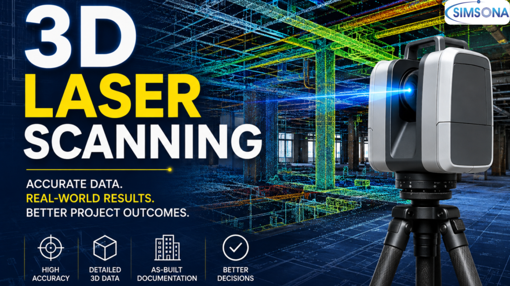
3D laser scanning provides a faster and highly detailed approach to capturing existing conditions. Using laser scanning technology, thousands or even millions of measurements can be collected from a site and converted into a detailed digital representation known as a point cloud.
For architects, engineers, contractors, fabricators, and building owners, 3D laser scanning can provide reliable existing-condition information that can be incorporated into design and construction workflows.
What Is 3D Laser Scanning?
3D laser scanning is a surveying and reality-capture technology used to collect precise three-dimensional information about physical spaces and objects.
A laser scanner is positioned at one or more locations within a building, construction site, industrial facility, or other environment. The scanner emits laser pulses and measures the time it takes for those pulses to return after interacting with surrounding surfaces.
The collected measurements are combined to create a dense collection of points representing the geometry of the scanned environment. This digital dataset is called a point cloud.
Depending on the project requirements, point-cloud data can be used for:
- Existing-condition documentation .
- As-built documentation .
- Building renovation and retrofit projects .
- BIM modeling .
- Structural analysis and design .
- MEP coordination.
- Clash detection.
- Construction progress monitoring.
- Quality control.
- Facility management.
- Industrial plant documentation.
Instead of relying entirely on manually collected dimensions, project teams can work from a comprehensive digital record of existing conditions.
Why Accurate Existing-Condition Measurements Matter
Designing around an existing structure presents different challenges than designing a completely new building.
Existing buildings may contain irregular walls, unexpected structural elements, outdated drawings, modifications from previous projects, or mechanical and electrical systems that are not accurately documented. Relying on old drawings or limited manual measurements can therefore introduce uncertainty into the design process.
For example, an engineer designing a new structural connection may need to know the exact location of existing beams, columns, slabs, walls, and other components. Similarly, an MEP designer working on a renovation project needs accurate information about existing ducts, pipes, equipment, and available space.
3D laser scanning helps capture these conditions before design or construction work begins.
The result is a more reliable basis for making project decisions.
How 3D Laser Scanning Works
A typical 3D laser scanning project begins with an assessment of the site and project requirements. The scanning team determines which areas need to be captured and identifies suitable scanner positions.
The scanner is then placed at multiple locations throughout the project area. Each scan captures the surrounding environment, creating a detailed three-dimensional dataset.
Because a single scanner position cannot always capture every surface, multiple scans are normally required. These individual scans are registered and combined into a unified point cloud.
The resulting dataset can then be processed, checked for quality, and delivered in a format compatible with the client’s design and coordination software.
This process allows project teams to move from physical site conditions to usable digital data.
Point Cloud Data and Deliverables
One of the most important outputs of a laser scanning project is the point cloud.
A point cloud contains millions of individual points representing the surfaces captured during scanning. Depending on the scanning equipment and processing requirements, the data can include detailed information about walls, floors, ceilings, structural members, equipment, piping, ductwork, and other physical elements.
Point-cloud files can be delivered in several industry-standard formats depending on the client’s workflow and software requirements.
Common formats include:
- Leica: PTX, PTS, PTG.
- Autodesk ReCap: RCS, RCP.
- Bentley: POD.
The appropriate format depends on how the data will be used and the software environment of the project team.
For projects involving BIM, point-cloud data can also serve as a reference for developing accurate as-built or existing-condition models.
Applications of 3D Laser Scanning
Existing-Condition Documentation
One of the most common applications of laser scanning is documenting existing conditions.
Instead of collecting a limited number of individual measurements, scanning captures a much larger amount of geometric information. This can be particularly valuable for older buildings where original drawings may be incomplete or unavailable.
The resulting point cloud provides a digital record that can be referenced during design and construction.
As-Built Documentation
Construction projects often require documentation of what was actually built.
Laser scanning can be used to capture completed construction and compare the scanned conditions with design information. This can help identify discrepancies and provide a more accurate record of the finished project.
As-built scanning can also be useful for future renovation, maintenance, and facility-management activities.
BIM and Scan-to-BIM
3D laser scanning is closely connected with Scan-to-BIM workflows.
In a Scan-to-BIM process, point-cloud information is used as the geometric reference for creating a Building Information Modeling (BIM) model of an existing facility.
Architectural, structural, and MEP elements can be modeled from the captured information, providing project teams with a digital representation of the existing building.
This approach can be especially valuable for renovation, expansion, retrofit, and adaptive-reuse projects.
Clash Detection
Existing buildings can contain complicated combinations of structural and MEP systems.
Laser scanning can provide accurate spatial information that helps project teams identify potential conflicts between existing conditions and proposed designs.
For example, a proposed duct may conflict with an existing beam, pipe, cable tray, or piece of equipment. Identifying such conflicts during design is generally preferable to discovering them during construction.
Construction Progress Monitoring
3D scanning can also be used throughout the construction lifecycle.
Periodic scans can capture the current condition of a project and provide a basis for comparing actual construction progress against design information or previous scans.
This can support project management, documentation, quality control, and coordination.
Quality Control
Laser scanning can provide another layer of verification for construction projects.
Captured site conditions can be compared with design models or drawings to identify deviations and potential issues. This can help project teams address problems before they become more expensive to correct.
Benefits of 3D Laser Scanning
Reduces Reliance on Manual Measurements
Traditional field measurement can require significant time and labor, particularly on large or complicated sites.
Laser scanning captures a substantial amount of information during the scanning process, reducing the need for teams to manually measure every individual feature.
Helps Reduce Project Delays
Incomplete or inaccurate existing-condition information can result in redesign, field changes, fabrication problems, and construction delays.
By providing detailed information earlier in the project, laser scanning can help reduce uncertainty and improve coordination.
Supports Better Design Decisions
Design teams can work from a more comprehensive understanding of existing conditions.
This is particularly important when designing additions, renovations, structural modifications, or new MEP systems around existing construction.
Improves Coordination
A common digital reference makes it easier for architects, engineers, contractors, fabricators, and other project participants to coordinate their work.
Point clouds can be incorporated into design and BIM workflows, allowing proposed elements to be reviewed against actual site conditions.
Reduces the Need for Repeated Site Visits
Once the existing conditions have been captured, the point cloud can be referenced by different members of the project team.
This can reduce the need to repeatedly return to the site simply to collect additional measurements.
3D Laser Scanning vs. Traditional Field Measurement
Traditional field measurement remains useful for many projects, but it can become inefficient when a project involves complex geometry or large areas.
Manual measurement generally involves identifying specific dimensions and recording them individually. Laser scanning, in contrast, captures a large amount of spatial information across the scanned environment.
The difference becomes particularly significant in projects involving:
- Large commercial buildings.
- Industrial facilities.
- Complex structural systems.
- Mechanical rooms.
- Manufacturing facilities.
- Renovation projects.
- Historic buildings.
- Areas with difficult access.
- Facilities with extensive MEP systems.
Laser scanning does not necessarily eliminate the need for conventional measurements. Instead, it provides another level of documentation that can complement traditional surveying and field-verification methods.
3D Laser Scanning for Renovation and Retrofit Projects
Renovation projects are among the areas where laser scanning can provide significant value.
Existing buildings often change over time. Walls may have been relocated, equipment may have been added, structural components may have been modified, and MEP systems may differ from the original drawings.
When design teams rely solely on historical documentation, these differences may remain hidden until construction begins.
A laser scan provides an updated representation of the physical environment. Designers can use this information to understand the relationship between existing elements and proposed modifications.
This can make laser scanning particularly useful for building renovations, structural retrofits, facility upgrades, and adaptive-reuse projects.
Managing Large Laser Scanning Data
Laser scanning produces large datasets, and managing these files efficiently is an important part of the workflow.
Professional scanning services should include data organization, quality control, processing, and secure delivery. Depending on project requirements, point clouds and related files can be transferred through secure file-sharing platforms.
For example, Dropbox can be used for convenient transfer and access to large project files.
Proper data management ensures that the project team receives usable information without unnecessary delays or confusion.
What to Consider When Hiring a 3D Laser Scanning Company
Choosing a scanning provider involves more than simply selecting a company with laser scanning equipment.
Project teams should consider the provider’s experience with similar facilities, data-processing capabilities, quality-control procedures, file formats, geographic coverage, and ability to integrate scanning data into the broader design workflow.
It is also important to establish the required level of accuracy and the intended use of the scan before scanning begins.
A provider experienced in construction, structural engineering, BIM, and existing-condition documentation can better understand how the collected data will ultimately be used.
Simsona 3D Laser Scanning Services
Simsona’s 3D laser scanning services are designed to help project teams capture accurate existing-condition information for design, construction, coordination, and documentation.
Simsona provides on-site 3D laser scanning services nationwide, supporting projects that require detailed field documentation and digital reality capture.
Services can support several stages of the project lifecycle, including:
- Existing-condition documentation.
- Project management.
- Construction progress monitoring.
- As-built documentation.
- Clash detection.
- Quality control.
- Design coordination.
Simsona manages the scanning data and performs quality checks to help ensure that the delivered information meets project requirements.
Point-cloud deliverables can be provided in formats such as Leica PTX, PTS, and PTG; Autodesk ReCap RCS and RCP; and Bentley POD, depending on project needs.
By incorporating laser scanning into the design and construction workflow, project teams can reduce their reliance on extensive manual measurements, minimize unnecessary equipment rentals, and potentially reduce delays associated with incomplete or inaccurate field information.
Simsona also provides convenient and secure access to large project files through Dropbox, making it easier for project teams to receive and work with scanning data.
With more than 25 years of industry experience at the top-management level, Simsona combines technical capabilities with practical experience in the AEC industry.
Conclusion
Accurate existing-condition information is fundamental to successful design and construction, particularly when working with existing buildings and facilities.
3D laser scanning provides a powerful way to capture physical environments and convert them into detailed digital information. Point clouds can support BIM modeling, as-built documentation, clash detection, construction progress monitoring, quality control, renovation, and many other applications.
By reducing dependence on extensive manual measurements and providing project teams with a detailed digital reference, laser scanning can help improve coordination, reduce uncertainty, and support more informed project decisions.
For organizations working on complex existing-condition, renovation, structural, architectural, MEP, or construction projects, 3D laser scanning can be an important part of a modern digital project workflow.
Simsona’s 3D laser scanning capabilities provide project teams with scanning, data management, quality assurance, and point-cloud delivery services to support projects from initial field documentation through design and construction.
Frequently Asked Questions
What is 3D laser scanning used for?
3D laser scanning is used to capture accurate existing conditions for applications such as as-built documentation, BIM, renovation, structural design, MEP coordination, clash detection, construction progress monitoring, and quality control.
What is a point cloud?
A point cloud is a collection of millions of individual data points representing the surfaces and geometry captured during a 3D laser scan. Point clouds can be used as references for design, BIM modeling, coordination, and documentation.
Can 3D laser scanning be used for BIM?
Yes. Laser scanning is commonly used as part of Scan-to-BIM workflows. Point-cloud data can serve as the geometric reference for developing existing-condition BIM models.
What file formats can laser scanning data be delivered in?
Depending on the scanning equipment and project requirements, point-cloud data can be delivered in formats such as Leica PTX, PTS and PTG, Autodesk ReCap RCS and RCP, and Bentley POD.
Can laser scanning help with clash detection?
Yes. Point-cloud data can provide an accurate reference of existing conditions, allowing proposed designs to be reviewed against existing structural, architectural, mechanical, electrical, and plumbing elements.
Is 3D laser scanning available for projects outside a local area?
3D laser scanning services can be provided for projects in different geographic locations. Simsona offers nationwide scanning capabilities for projects requiring field data capture and point-cloud documentation.
Does laser scanning eliminate manual measurements?
Not always. Laser scanning can significantly reduce the amount of manual measurement required, but conventional field verification may still be appropriate depending on the project, accuracy requirements, and scope of work.
 301-774-0880