
GIS to BIM Data Integration: Simsona
Introduction
Modern construction and infrastructure projects are no longer limited to drawings and isolated 3D models. Today, decisions are driven by connected data systems that combine geography, engineering, and real-world context.
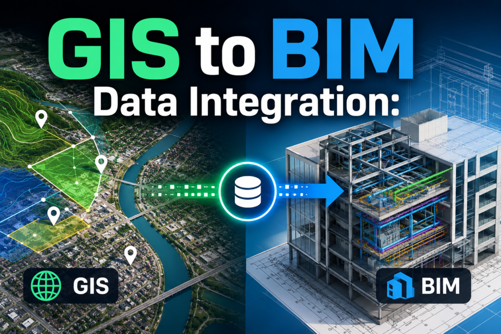
One of the most important advancements in this direction is GIS to BIM data integration, where spatial intelligence from geographic systems is combined with detailed building models.
This integration connects two powerful technologies:
Geographic Information Systems and Building Information Modeling, creating a unified digital environment that supports smarter planning, design, construction, and asset management.
In simple terms, GIS tells us where things exist, while BIM explains what they are and how they are built. When combined, they provide a complete picture of both environment and structure.
Understanding GIS to BIM Data Integration
GIS to BIM data integration is the process of bringing geospatial datasets and building information models into a single connected workflow.
Instead of treating GIS and BIM as separate tools used in different project stages, integration allows them to work together across the entire lifecycle of a project.
For example:
- GIS data helps identify suitable land, terrain conditions, flood zones, and urban surroundings.
- BIM data defines the exact structure, materials, systems, and construction details of a building.
When these datasets are combined, planners and engineers can see how a proposed structure interacts with its real-world environment before construction even begins.
Why GIS and BIM Integration Matters
Traditionally, GIS and BIM operated in silos. GIS was mainly used in early planning and large-scale mapping, while BIM focused on detailed building design.
This separation often caused issues such as:
- Poor coordination between planners and designers
- Lack of environmental context in BIM models
- Difficulty in evaluating real-world impact of designs
- Inefficient decision-making across project stages
GIS to BIM integration solves these problems by creating a continuous flow of information from planning to design to construction and even operations.
This is especially important in modern projects like smart cities, transport corridors, and large infrastructure developments where scale and detail must work together.
GIS to BIM Integration Workflow (Step-by-Step)
Although different organizations may follow slightly different methods, the core workflow remains similar.
1. Data Collection and Preparation
The process starts with gathering both GIS and BIM data:
- GIS data includes satellite imagery, terrain elevation models, land use data, environmental zones, and infrastructure maps.
- BIM data includes architectural models, structural frameworks, and MEP systems.
At this stage, data quality and accuracy are critical because errors here will affect the entire integration process.
2. Data Alignment and Standardization
GIS and BIM systems often use different formats and coordinate systems.
GIS typically uses global coordinate systems, while BIM models often use local project-based coordinates. Aligning these systems is necessary to ensure both datasets match in real-world space.
3. Georeferencing BIM Models
This step places BIM models into their correct geographic location.
A building designed in BIM is mapped onto real-world coordinates so it aligns with roads, terrain, and surrounding infrastructure.
4. Data Conversion and Interoperability
Since GIS and BIM tools use different file formats, conversion is required.
Common formats include IFC for BIM data and shapefiles or CityGML for GIS data. This ensures both systems can communicate effectively.
5. Integration in a Common Platform
Once aligned and converted, both datasets are brought into an integrated environment using platforms that support both GIS and BIM.
This allows users to visualize buildings within real-world maps and landscapes.
6. Analysis, Simulation, and Decision-Making
After integration, the combined model can be used for:
- Urban development planning
- Infrastructure optimization
- Environmental impact studies
- Transportation route analysis
- Construction feasibility studies
This is where GIS to BIM integration delivers its real value.
Key Benefits of GIS to BIM Data Integration
1. Better Planning with Real-World Context
Designs are no longer created in isolation. Engineers can see how a project fits into its surroundings, including terrain, roads, and existing infrastructure.
2. Improved Design Accuracy
By combining spatial and structural data, design conflicts are reduced significantly. This helps avoid costly redesigns during construction.
3. Faster Decision-Making
Stakeholders can evaluate multiple design options quickly using integrated visual and analytical models.
4. Cost and Time Efficiency
Early detection of site-related issues reduces delays, material wastage, and unexpected expenses.
5. Foundation for Smart Cities
GIS-BIM integration plays a major role in developing digital twins of cities, where real-time data is used for monitoring and planning urban systems.
6. Lifecycle Management of Assets
Beyond construction, integrated models help manage buildings and infrastructure throughout their operational life, including maintenance and upgrades.
Real-World Applications
Urban Development and Smart Cities
City planners use GIS-BIM integration to design zoning layouts, transportation networks, and public infrastructure with real-world accuracy.
Transportation Infrastructure
Roads, railways, airports, and bridges are designed considering terrain, population density, and environmental constraints.
Utility and Infrastructure Networks
Water supply systems, drainage networks, and electrical grids benefit from spatial accuracy and better coordination.
Disaster and Risk Management
Flood modeling, earthquake risk analysis, and evacuation planning become more precise using integrated data.
Environmental Planning
Impact assessments become more reliable when construction data is combined with environmental GIS layers.
Challenges in GIS to BIM Integration
Despite its advantages, integration is not without challenges.
Data Compatibility Issues
Different software systems and file formats often make direct integration complex.
Coordinate System Conflicts
GIS uses global positioning systems, while BIM uses local design coordinates, requiring careful alignment.
High Computational Requirements
Integrated datasets can become large and require powerful systems to process and visualize.
Lack of Universal Standards
There is still no fully standardized global framework for seamless GIS-BIM integration.
Skill Gaps in Industry
Many professionals specialize in either GIS or BIM, but not both, making collaboration more difficult.
Tools Used in GIS to BIM Integration
Several tools support GIS-BIM workflows:
- BIM modeling software for detailed building design
- Esri ArcGIS for spatial analysis and mapping
- Autodesk InfraWorks for infrastructure modeling
- Navisworks for coordination and clash detection
- QGIS for open-source geospatial processing
Future of GIS to BIM Integration
The future of GIS and BIM integration is moving toward fully connected digital ecosystems.
Some key trends include:
- AI-powered spatial analysis and predictive modeling
- Real-time digital twins of cities and infrastructure
- Cloud-based collaboration platforms for global teams
- IoT-enabled smart infrastructure monitoring
- Automated construction planning and simulation
Over time, the boundary between GIS and BIM will continue to fade, leading to a unified digital environment for the built world.
Conclusion
GIS to BIM data integration is transforming how the construction and infrastructure industries operate. By combining geographic intelligence with detailed building information, it creates a complete digital representation of both environment and structure.
This integration improves planning accuracy, reduces project risks, and supports long-term asset management. More importantly, it forms the backbone of smart cities and future-ready infrastructure systems.
As technology continues to evolve, GIS and BIM will no longer be separate disciplines but interconnected layers of a single intelligent ecosystem that shapes how we design and build the world around us.


 301-774-0880